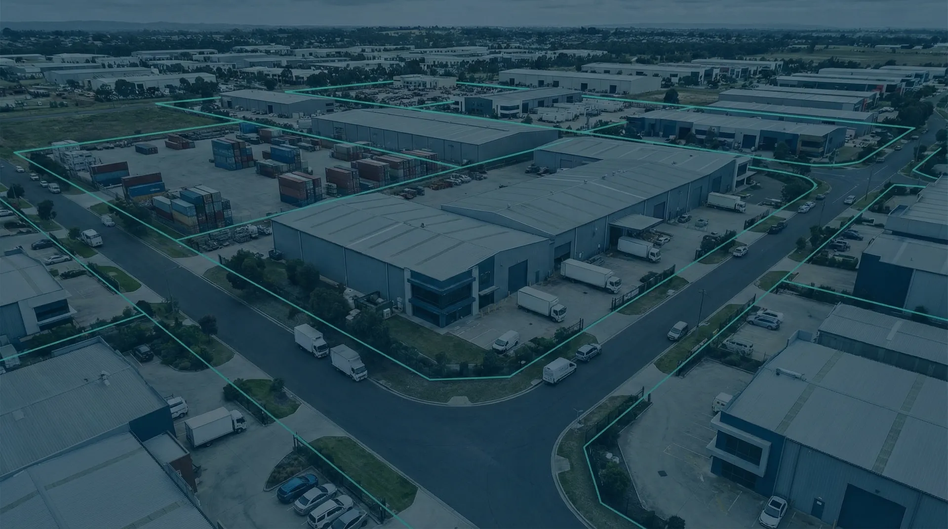
Geofencing fleet management
Geofencing is a location-based technology that creates virtual boundaries around geographic areas. When a vehicle equipped with a GPS tracking system enters or leaves a geofenced zone, you receive alerts instantly. Improve your fleet operations with automated site verification and audit-ready compliance records.


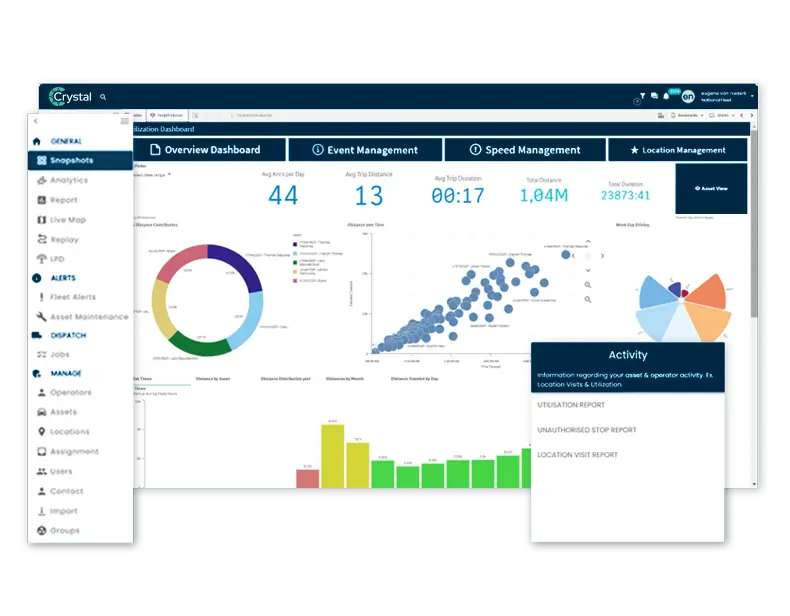
Run Your Fleet's Geofences From One Screen
- Draw geofence zones that fit: custom polygon zones around job sites, depots and customer addresses, not just rough circles.
- Know the moment a vehicle crosses: enter and exit alerts reach the right people in near real time.
- Prove site arrivals on their own: timestamped entry and exit records feed payroll, billing and compliance.
- Set the rules per zone: speed thresholds, dwell time and after-hours alerts where each one belongs.
- One Crystal screen for the whole fleet: unlimited zones with no per-zone fees, ten vehicles or ten thousand.
Book a Demo
Review Ctrack geofencing in a personalised demo to learn how geofence zones verify site arrivals, automate compliance records, and run your fleet from one screen.
Geofencing in fleet management use cases
Geofencing is a location-based technology that allows you to create a virtual boundary around a geographic area on a digital map. When a vehicle crosses this boundary, the system logs the event automatically. You define geofences around customer sites, depots, service territories, or restricted areas based on your fleet operations.
Fleet managers use geofencing to verify site arrivals, monitor territory compliance, and detect route deviations in real-time. The software works through location-based monitoring using GPS and RFID signals. When one of your vehicles enters or leaves a defined area, the system can trigger a specific action. Teams gain visibility across your fleet without manual log checking.
Common applications include construction site attendance, customer delivery verification, and depot access monitoring. Service businesses measure time spent at each location for accurate billing. For example, you might create a geofence around the office or a customer site. When a vehicle enters or exits, the software records arrival and departure times automatically. Security teams monitor restricted zone compliance using telematics data.
Geofencing workflow for fleet managers
Ctrack geofencing software is easy to use. Three steps from zone creation to automated site monitoring across your entire fleet.
Draw your zones
Use the Ctrack platform to set up geofences around any location on the digital map. Draw custom polygon shapes that match actual site boundaries, or use radius-based circles for simpler zones. Create a virtual boundary around a geographic area, name each zone, and assign it to a category for organised reporting.
Configure alerts and rules
Set entry and exit rules for each zone. Configure who receives alerts -- dispatchers, managers, or clients. Apply zone-specific speed limits and set time-based rules for after-hours detection. The system notifies you when a vehicle enters or leaves a designated area. Assign different vehicle groups to different zone rules.
Monitor and report
View real-time zone occupancy on the dashboard. Access historical reports showing time-on-site, visit frequency, and compliance. Export data analytics to payroll or ERP systems. Use fleet analytics to identify patterns, reduce idle time, and improve productivity.
Geofencing software advantages with Ctrack
One platform. Three pillars. Complete fleet intelligence.
Predict
Foresight that keeps your fleet moving. Anticipate maintenance, optimise routes, and reduce costs before issues arise.
Protect
AI-powered safety without surveillance. Real-time fatigue detection, driver coaching, and claims exoneration.
Comply
Built-in compliance that scales. Centralised records, audit-ready reports, and continuous regulatory alignment.
Benefits of Geofencing for Fleet Efficiency
Geofencing can help improve fleet management by eliminating manual site verification and automating compliance documentation. Fleet vehicles that enter or exit a zone are logged automatically. Here are the key benefits of geofencing for operations.
Managers receive alerts when vehicles arrive at or depart from customer locations. When a vehicle enters a geofenced area, the system logs arrival automatically for timesheet validation.
Vehicles operating outside approved zones become immediately visible. Receive alerts when a vehicle has left its designated area or operates outside approved boundaries after hours.
Accurate arrival records improve efficiency and SLA compliance. Prove exact arrival and departure times for billing verification, reducing disputes.
Every zone crossing creates a timestamped record. Generate audit-ready reports for Chain of Responsibility requirements and fleet safety compliance with boundary on a map monitoring.
Geofencing to Improve Fleet Management
Fleet management tools apply virtual perimeters around specific areas to manage your fleet more effectively. From construction to delivery, geofencing solutions transform operations and reduce fuel costs.
Ctrack Geofencing Capabilities
- Unlimited geofence creation with no per-zone fees
- Custom polygon boundary zones matching actual site perimeters
- Multi-level alert messaging to managers and stakeholders
- Real-time dashboards showing vehicles inside each zone
- Historical reports and data exports for payroll/ERP
- Speed monitoring within designated geofenced zones
Custom Geofence Boundaries for Your Fleet
Standard circular zones often miss actual site perimeters. Ctrack fleet management software supports custom polygon shapes. Draw zones around any specific area that match property lines, warehouse loading areas, or construction site perimeters exactly.
Create zones around parking areas, customer entrances, or specific work areas within larger sites. Set up multiple zones with different rules for different vehicles. A large depot might have a geofence around the main yard, fuel station, and maintenance bay. Managers can assign rules to each zone independently.
Adjust zone sizes as projects change. The software is easy to use -- set up zones in minutes through the web interface or mobile app. Changes take effect immediately across your fleet. Temporary zones for short-term projects activate and deactivate on schedule, giving you complete control over boundary monitoring.
Geofencing ROI: Improve Fleet Efficiency and Productivity
Australian operators report measurable improvements in operational efficiency, compliance, and cost reduction after deploying zone monitoring across their vehicles.
Fleet management software reduces administrative time by 60-80% through automated zone reporting, arrival notifications, and timesheet generation.
Automated site arrival and departure logging eliminates manual timesheet errors and disputes. Data feeds directly into payroll and billing systems.
Geofence alerts flag after-hours movement, unapproved site visits and out-of-zone driving the moment they happen, so misuse is caught early instead of showing up on the invoice.
Geofencing for Fleet: Frequently Asked Questions
Start Using Geofencing to Improve Your Fleet
Geofencing transforms fleet management from reactive to proactive. You gain instant visibility into vehicle movements and compliance documentation. Ctrack provides unlimited zones, custom polygon shapes, and full integration with your tracking platform.
Start with your biggest priority. Then expand into analytics, safety, and compliance as you grow.